-
Task
-
Resolution: Unresolved
-
 Not Evaluated
-
None
-
Qt 3D Studio 2.7
-
None
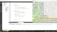
i want to display geojson file on maps and make these shapes clickable to show more details about a building for example.
what i get is just a coordinate ... i need to get geojson object of building clicked
// code placeholder
Map {
        id: map
        anchors.fill: parent
        plugin: Plugin {
            name: "mapboxgl"
            PluginParameter {
                name: "mapboxgl.access_token"
                value:"sk.eyJ1IjoiYWxub29yLXNjaG9vbCIsImEiOiJjbGF1cmd0YTEwOWNoM3ByNjdxaW0yZXZiIn0.-RGpdTPTSBqrUGc65oLPNQ"
            }
 MouseArea {
            acceptedButtons: Qt.LeftButton | Qt.RightButton
            anchors.fill: parent
 onClicked: {
                mouse.accepted=true
                if (mouse.button == Qt.LeftButton) {
                    var coord = map.toCoordinate(Qt.point(mouse.x,mouse.y));
                    console.log(coord.latitude, coord.longitude)
                    console.log(JSON.stringify(mouse) )
            }
        }


  DynamicParameter  {
            type: "source"
            property var name: "buildingSource"
            property var sourceType: "geojson"
            property var data: ":building.json"
        }
        DynamicParameter  {
            type: "layer"
            property var name: "buildingLayer"
            property var layerType: "fill"
            property var source: "buildingSource"
        }
        DynamicParameter  {
            type: "paint"
            property var layer: "buildingLayer"
            property var fillColor: "#bbb"
        }
