Uploaded image for project: 'Qt'
  1. Qt
  2. QTBUG-110511

Rendering errors in QMapItems (Visible in GeoJSON Viewer example)

    XMLWordPrintable

Details

    • Bug
    • Resolution: Fixed
    • P5: Not important
    • 6.5.0, 6.6.0
    • 6.5
    • Location
    • None
    • All
    • 8b9ecad4b (dev), 1ed08dc97 (6.5)

    Description

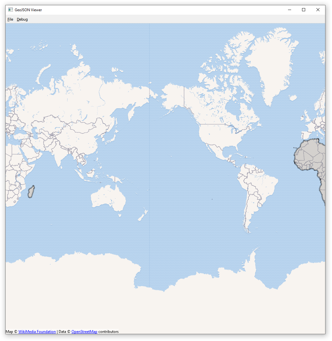
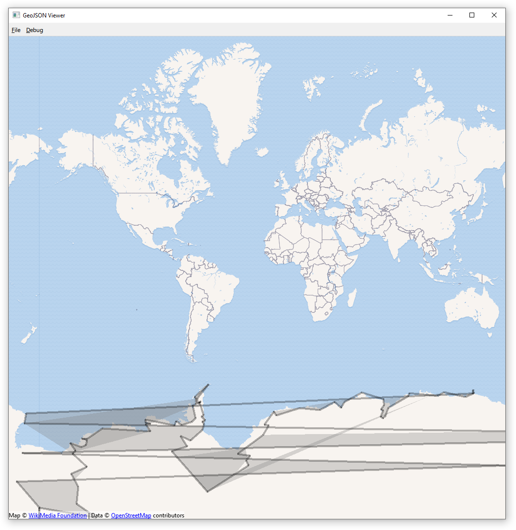
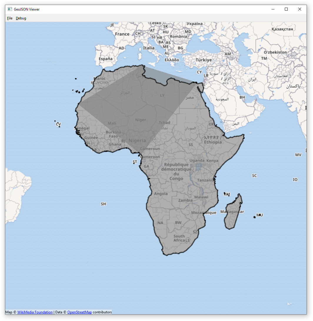
      The example GeoJSON Viewer can be used to visualize geographic shapes in from of GeoJSON files. Some examples are not rendered as expected and as on other platforms.

      The following unexpected behavior was found:

      1. If a MapPolygon should appear on both sides of the map (the map is periodic between -180 and 180) it appears only on one side of the map.
      2. If a MapPolygon is crossing the "date line" (longitude = -180 = 180) multiple times it is not rendered correctly.
      3. Complex MapPolygons are not rendered correctly at some zoom levels.

      The error can be reproduced with the appended GeoJson files. The continent shapes are taken from https://gist.github.com/hrbrmstr/91ea5cc9474286c72838?short_path=f3fde31. They are verified with QGis. 

      Attachments

        1. 1_africa2.png
          1_africa2.png
          263 kB
        2. 2_antarctica_simpl.png
          2_antarctica_simpl.png
          275 kB
        3. 3_africa.png
          3_africa.png
          559 kB
        4. africa.json
          37 kB
        5. antarctica_simpl.json
          4 kB
        No reviews matched the request. Check your Options in the drop-down menu of this sections header.

        Activity

          People

            matthias_rauter Matthias Rauter
            matthias_rauter Matthias Rauter
            Votes:
            0 Vote for this issue
            Watchers:
            2 Start watching this issue

            Dates

              Created:
              Updated:
              Resolved:

              Gerrit Reviews

                There are no open Gerrit changes